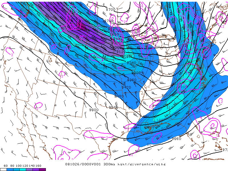
This Isotach map of RUC shows its base 300mb analysis of geopotential height (solid black lines, every 60m), divergence (solid magenta contours, every 2x10⁻⁵s-1, and isotachs (color filled every 10kt above 60kt) at 00z October 26th.
Source:http://www.erh.noaa.gov/btv/events/28Oct2008/ua2.php
No comments:
Post a Comment